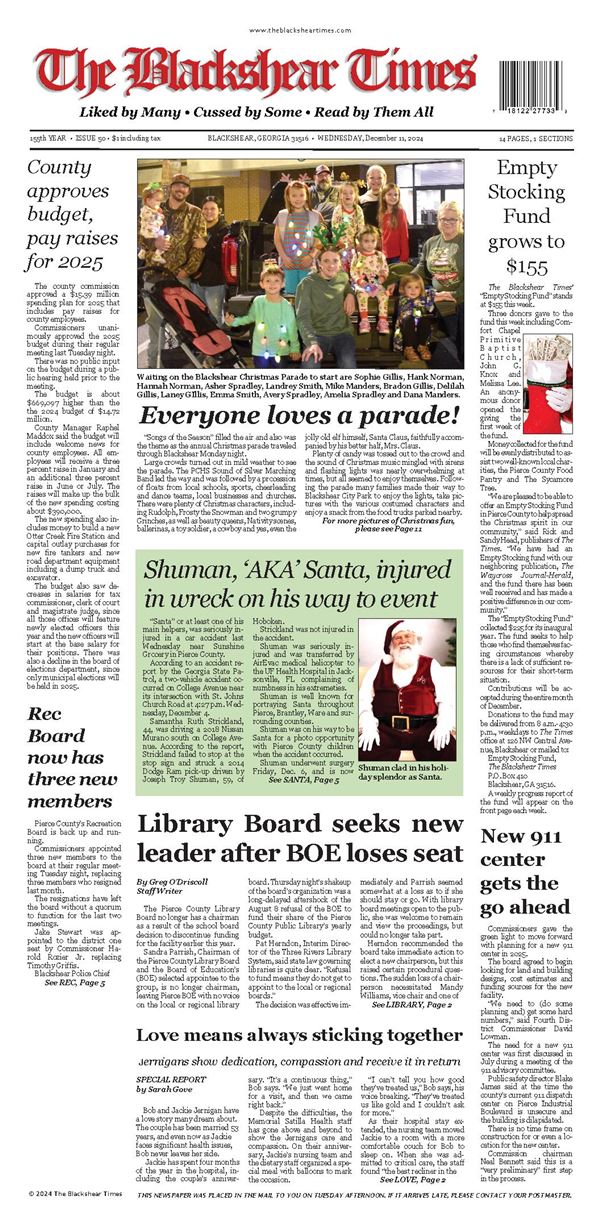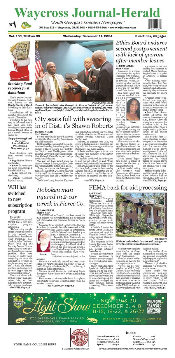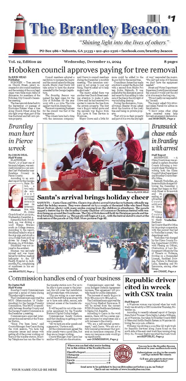

Some skepticism follows National Weather Service rating
The National Weather Service in Jacksonville said a tornado struck Waycross Monday evening, April 7 as part of the severe storms that rolled through the area.
What resulted from the reported twister’s path through a portion of the city’s Cherokee Heights neighborhood have some wondering about the storm’s severity.
Ware County Emergency Management Director Jonathan Daniell said Wednesday he didn’t receive notice of a visit by NWS officials to rate the storm’s level. He also said he wasn’t informed a tornado had been confirmed as a result of the survey.
“I didn’t get a call, but I did see the news reports,” Daniell said. “I didn’t know (about a tornado) until then.”
Waycross Fire Department Chief Jim Blackburn Jr., said Friday there was one 9-1-1 call as a result of the storm — for a tree down across Camilla Drive near its intersection with Morningside Drive. He said firefighters sectioned the tree and cut its limbs Monday evening.
Chief Blackburn said personnel also found some small limbs down on Coral Road while traveling through the area and removed those. The city’s Public Works department removed all the debris the fire department handled and anything else Tuesday.
According to the NWS report, the tornado began around 7:03 p.m. near Magnolia Street and Clifton Grove Street, and remained on the ground for five minutes. The twister dissipated just north of Jasmine Circle near Caney Branch Stream, the report said.
The tornado was rated EF-0 on the Enhanced Fujita Scale, said Scott Cordero of the NWS.

A residence in Cherokee Heights had a portion of its patio roof collapse during the reported tornado Monday evening, April 7 from one of the severe storms that moved through the area. SPECIAL PHOTO
EF-0 tornadoes are the lowest on the scale and have wind speeds of 6585 mph causing minor damage like broken limbs, peeling roofs and downed small trees. By comparison, EF-5 tornadoes have winds of 200 mph and result in catastrophic damage to structures.
Chief Blackburn said he was in the area of the tornado shortly after it struck. He said he drove through the neighborhood the NWS later determined included the tornado’s path, which was estimated to be between 20 and 50 yards wide and 1.72 miles long.
“I was kind of shocked when I heard (tornado) went through there,” he said.
Added Daniell: “If it was on the ground that long, you’d think there would’ve been more damage.”
While the tornado lifted, strong straight line winds continued into Pierce County, reports said. Power lines were down along U.S. 84 near Patterson, Pierce County authorities said.
There were no reports of power outages in Ware County.
After a day under thunderstorm and tornado watches, a severe thunderstorm capable of producing a tornado was located over Boggy Bay near Waycross, moving northeast at 55 mph, the NWS said. That resulted in the tornado warning just before 7 p.m. for east central Ware, southeastern Pierce and west central Brantley counties.
At 7:15, another thunderstorm cell with the capability to produce a tornado was detected by radar near Blackshear moving northeast at 60 mph, the NWS said.
The area went under a thunderstorm watch early in the day. A tornado watch was added in the early afternoon and a thunderstorm warning followed shortly after 6 p.m. until being replaced by the tornado warning.
In preparation for expected heavy precipitation forecast for the afternoon and evening, Waycross had public works crews working in and around the canal system to make them as clear as possible for storm water runoff.
City Hall closed at 2 p.m. After showers early in the afternoon, a steady rain began falling about 5:15 and continued until just before 7 p.m. when it strengthened in intensity with the arrival of the storm that produced the tornado. Heavy rain continued until 7:35 when it lightened for the next few hours.
Total precipitation from mid-afternoon to midnight was 1.3 inches.
The website USA.com includes a section on natural disasters, and lists tornadoes of magnitude EF-2 or greater. The historial list includes two each for Ware and Pierce counties and one for Brantley.
Those for Ware were November 18, 1968 (EF-3) and February 25, 1970 (2).
The first was 33 yards wide and one-half mile long and caused an estimated $25,000 damage for the time. The second was 100 yards wide and 10.9 miles in length causing $250,000 damage. There were two injuries resulting from the second twister.
Those in Pierce were April 12, 1961 (2) and March 16, 1976 (2).
The first was 33 yards wide over 15.7 miles and caused $25,000 damage with two injuries. The second was 100 yards wide over .3 miles for $250,000 damage with injuries.
Brantley’s entry on the list came January 13, 1963 (2), and was 300 yards wide over a mile causing $25,000 damage with no injuries.