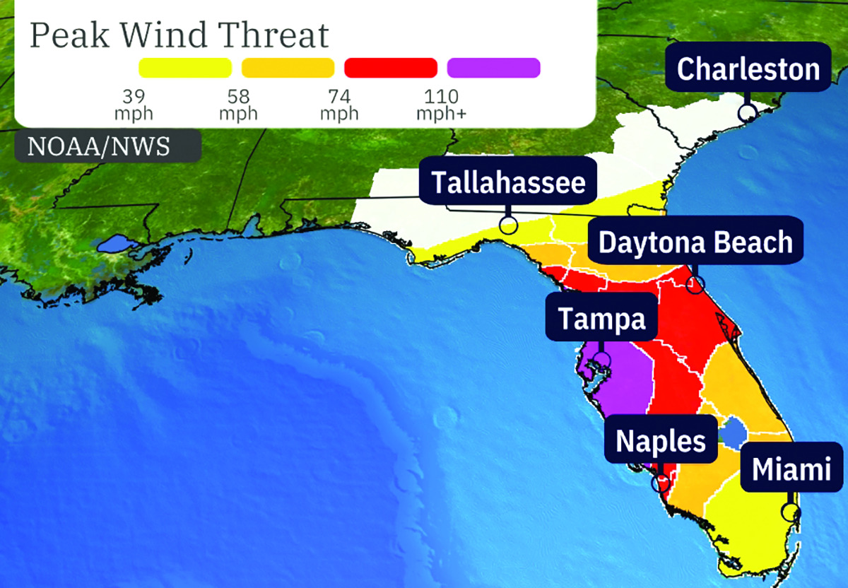
Less than two weeks after Hurricane Helene made landfall and impacted much of South Georgia, northeast Florida and southeast Georgia are again preparing for another hurricane from the Gulf coast.
Hurricane Milton is a major hurricane that is expected to make landfall mid-week along the Florida west coast. It is the fifth to hit mainland this year.
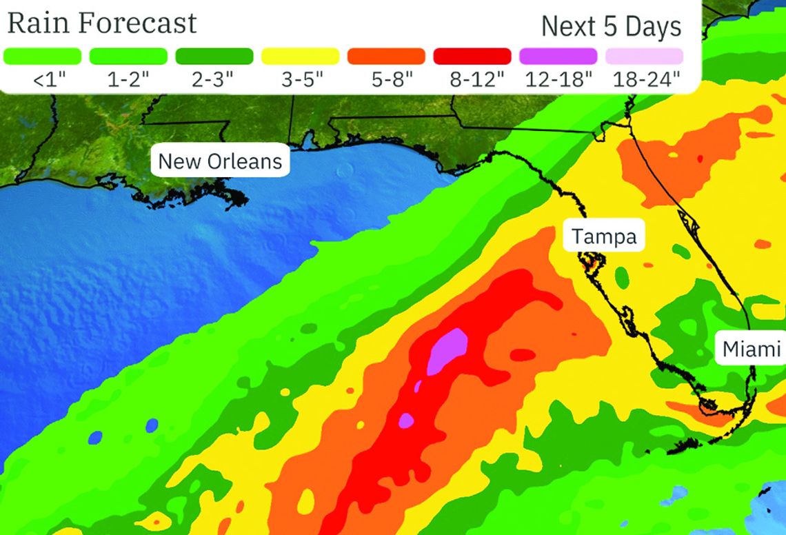
Milton is expected to bring heavy amounts of rain along with some wind to southeast Georgia, according to Ware County Emergency Management Director Jonathan Daniell.
“It will mainly be a rain event for us here,” Daniell said. “We can expect around one to two inches of rain along with some wind for our area.”
Daniell mentioned Waycross will feel the effects of the outer bands beginning today (Wednesday, October 9).
The National Weather Service says the greatest impacted areas will northeast Florida and southeast Georgia.
As of Monday (October 7), Waycross is in a slight risk of flooding with the heaviest rainfall potential for Tuesday night (October 8) through Wednesday night (October 9).
The storm quickly strengthened into a Category 5 hurricane Monday, October 7, after intensifying rapidly over the warm water in the Gulf of Mexico. It is the second Category 5 storm of the 2024 Atlantic hurricane season, joining Beryl.

Milton’s intensity “should be dictated by any eye-wall replacement cycles, which will likely cause the system to gradually weaken but grow larger,” the National Hurricane Center said in an advisory.
Since 1950, only five other years have had at least two Atlantic Category 5 hurricanes, according to Colorado State University hurricane researcher Phil Klotzbach — 1961: Esther, Hattie; 2005: Emily, Katrina, Rita, Wilma; 2007: Dean, Felix; 2017: Irma, Maria; 2019: Dorian, Lorenzo.
Only four hurricanes have ever hit the U.S. at Cat 5 strength — the most recent being Hurricane Michael in 2018.
As of 1:30 p.m., Monday, maximum sustained winds reached 160 mph, doubling its wind speed in 48 hours. The NWS predicted it would max out at 165 mph in 12 hours and gradually weaken.
The latest models show the storm going straight across the state of Florida and into the Atlantic.
According to the NWS, onshore winds will strengthen late Tuesday, October 8, and continue through Thursday, October 10. The winds could possibly bring even more power outages, tree and structure damage.
Many in Ware and surrounding counties are still recovering from Hurricane Helene after it left power outages throughout the state, many still active.
As of Monday morning, Georgia Power reported it still had 19,071 customers without power with five of those being in Ware County.
Satilla REMC reported it has 28,779 outages still to fix with the majority of those (9,796) in Coffee County . Other outages in the Satilla REMC coverage area include Ware County with 2,083, Pierce County with 7,245 and Bacon County with 5,446.
Okefenoke REMC reports it currently has only one outage in Camden County.


