Rain causes most problems from visit by tropical storm
Waycross and Ware County weren’t heavily impacted by the remnants of Hurricane Debby early last week, officials said.
Sporadic power outages, mostly from fallen trees in city neighborhoods, flooding on outlying dirt roads and a delay in opening school were the major issues the city and county experienced from Debby’s visit as a tropical storm.
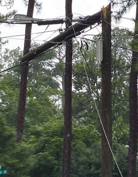
In addition to dropping power lines, one of the trees came down on a pool “cage” at a house in Cherokee Heights.
After making landfall as a Category 1 hurricane in Florida’s Big Bend area, Debby arrived in the early morning hours of Monday (August 5). Her outer rain bands began showing in Waycross around dawn Monday and continued through Tuesday night (August 6).
A total of 10.8 inches of rain fell from 7 a.m. Monday through midnight Tuesday, the National Weather Service said. Of that total, 8.1 inches fell from 7 a.m. to midnight Monday.
The rain sent the Satilla River out of its banks on Wednesday, rising above its flood stage of 16 feet in Waycross. The river topped at 18.2 feet late Thursday and fell through the weekend, measuring 16.2 feet Monday morning (August 12).
It was expected to fall below flood stage later Monday ending the weeklong flood warning toward a final level of 13.8 feet Thursday morning, according to the NWS.
Tropical storm force winds appeared only in gusts, measuring 44 mph at 10:35 a.m. and 43 mph at 9:35 p.m. Monday. The top gust was part of the highest maximum sustained winds of 31 mph also registered at 10:35 a.m.
“We were fortunate it was mostly a rain event,” Ware County Emergency Management Director Jonathan Daniell said. “There was very little damage from wind, not a lot of debris and nothing major from the areas that flooded.
“The biggest thing was probably washouts on the dirt roads. A lot of them were flooded or had water running over them for quite a while.” James Smart, the city’s Public Works Director, said there were very few areas of standing water on streets during the heaviest rains thanks largely to the canal system.

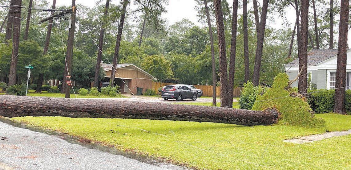
The weight of the pine tree falling on power lines easily snapped this power pole at Euclid Avenue and Tupelo Avenue. Photo by EJ POND
“The canals worked as they should,” said Smart, whose staff made clearing vegetation in the waterways a priority ahead of the storm. “One in Pernell Roberts (Memorial Park) got out (of its banks), but not very far or for very long.”
School was scheduled to open in Ware County Thursday (August 8), but was delayed until Monday (August 12). Classes also began Monday in Pierce and Brantley counties after scheduled starts of Monday, August 5 and Tuesday, August 6, respectively.
Daniell said getting the county’s dirt roads in a condition to handle school buses would be a priority through the weekend.
“There are still some they’re working on and a couple may be closed,” Daniell said Monday afternoon. “They worked diligently through the weekend to get them passable for the school buses.
“I haven’t heard of any issues for them so far.”
The area went under a tropical storm watch Friday (August 2) by the NWS, and it was upgraded to a warning two days later. A flood warning followed early Monday when the Satilla’s level was 11.6 feet at 8:45 a.m.
The heaviest rain during the storm (3.7 inches) fell between 10 a.m. and 1 p.m. Monday. Of that total, 1.6 inches was recorded between 11:35 and noon.
That led to the river quickly rising to top flood stage early Wednesday. Its level was 17.9 feet at 7:45 a.m. Thursday on the way to the crest.
Power outages in the county were widespread. All areas had power restored by Wednesday evening, according to a check of Georgia Power’s outage map.
Other than the clean up of the downed trees in city neighborhoods, which Smart estimated at “eight to 10” there was very little debris left by the storm.
“Our parks didn’t have any damage or much cleanup,” Smart said, mentioning a window in City Hall as the lone damage to city-owned property.
He said most of his crews had resumed their normal work schedules Wednesday.
“We faired a lot better than with Idalia,” Daniell said of the Cat 3 hurricane’s trip through the area August 3031, 2023 as a tropical storm. “We didn’t have near the debris or power problems we did then.”
Wind was Idalia’s calling card with numerous gusts registered at 50-plus mph and one just short of hurricane strength of 75 mph.
Some homes were without power for three days.


